Implemented by Wien Energie together with numerous partners from science, research and industry,1 the GeoTief project is concerned with systematically studying and measuring the geological subsurface in the Vienna Basin. GeoTief is Austria’s largest geological research project and is regarded throughout Europe as a shining example of integrated research in this sector. The aim is to put a figure on the potential value of deep geothermal energy for heating the greater Vienna area and thus aid decision-making for future heating projects. Hydrothermal energy, i.e. the use of hot springs deep below the surface, is a local, renewable and environmentally friendly thermal energy source and can be harnessed as a feed-in system for district heating networks that is capable of providing baseload power. The City of Vienna’s strategies (e.g. its Energy Framework Strategy 20302) name hydrothermal energy as an important sustainable technology for the future.
Potential for supplying heating
The Vienna Basin is believed to hold between 40% and 60% of the estimated usable capacity of this form of energy in Austria (450-700 MW of thermal energy).3 At the same time, the Vienna conurbation is home to one of the biggest district heating networks in Europe. Geothermal energy could play a major role in further increasing the percentage of district heating generated from renewable energy sources and making Vienna’s existing district heating network even more efficient and sustainable. Wien Energie has set itself the target of installing 140 MW of geothermal energy by 2030, enough to supply 135,000 homes and save up to 260,000 t CO2 per year. The GeoTief project creates the scientific basis to underpin this ambition.
Seismic Measurements
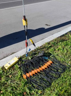
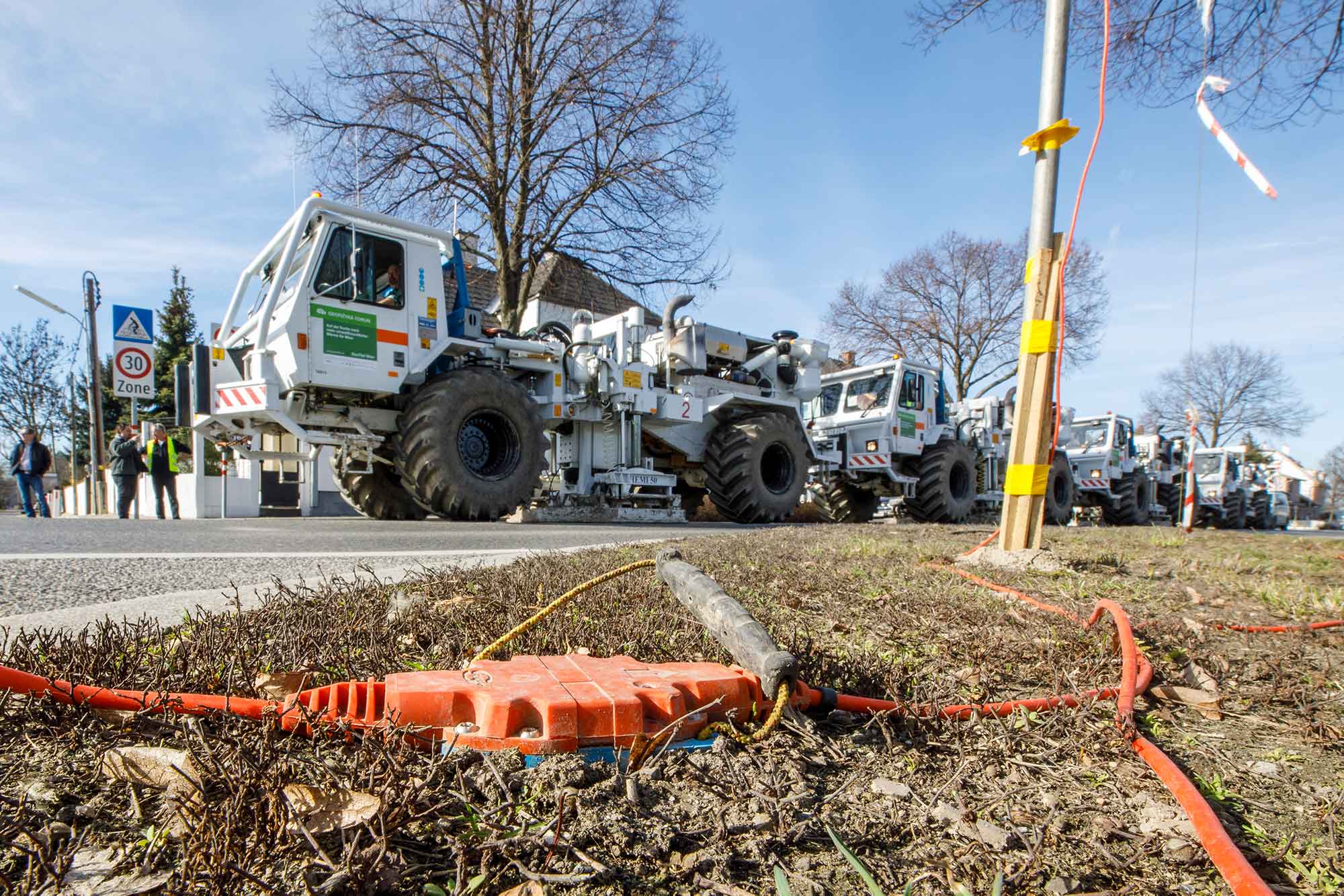
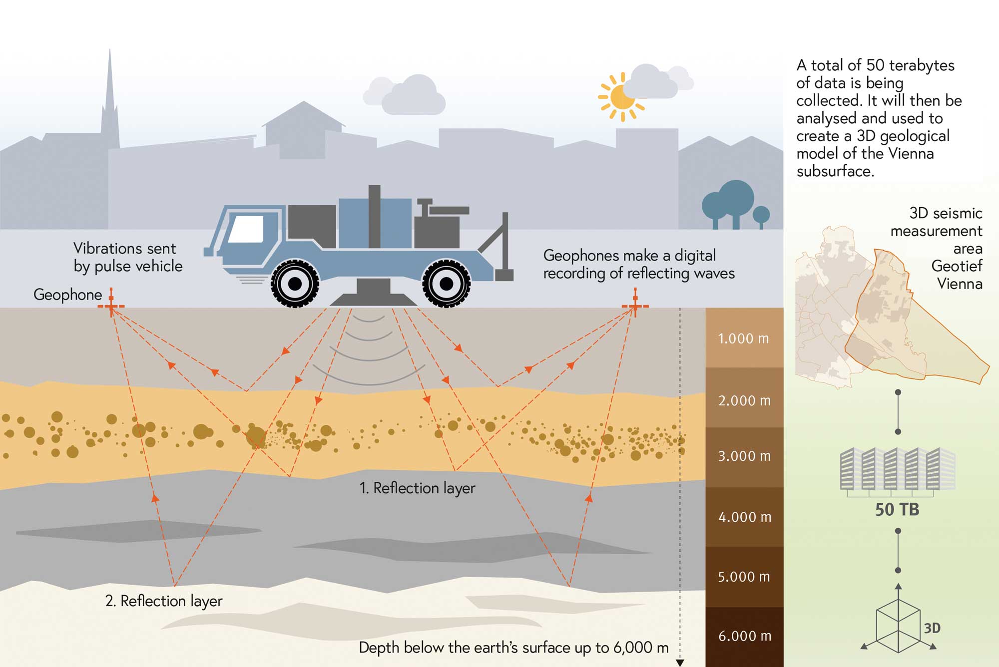
At the heart of the project are two phases of seismic measurements. As part of the GeoTief BASE (2D) project, seismic 2D measurements were taken in a densely built-up urban area in 2017 to explore the deep subsurface in detail – the first time this had been done in Austria. Building on this, the follow-on project GeoTief EXPLORE (3D) conducted comprehensive 3D seismic measurements in autumn 2018. These measurements were only done on the Earth’s surface. For decades, seismic measurements have been carried out all over the world in order to explore the geological structures and rock strata that exist beneath the surface. Reflection seismo-logy is a technique used to map the depths and geometries of the boundaries between geological strata in the interior of the Earth. Seismic measurements allow the subsurface to be studied in a similar way to echo sounding. Vibrations are sent deep into the Earth along roads and paths. The signal is reflected underground and recorded by sensors set up close to the measuring vehicles.
Analysing the data
The data from the seismic measurements – some 50 terabytes’ worth – is currently being scientifically evaluated in a two-year analytical phase. Additional tests and surveys are being carried out at the same time, including some in old wells and at the surface. The water-bearing rocks beneath Vienna are similar to those found in the Limestone Alps (Kalkalpen) mountain range south of the city (e.g. Hohe Wand). Scientists from the University of Vienna, the Geological Survey of Austria and the German Research Center for Geosciences (GFZ Potsdam) are therefore analysing rock samples from the range and from local stone quarries at the surface in order to study the properties of these rocks in the subsurface (e.g. their permeability to water). All information and data are being incorporated into a 3D geological model that provides an accurate picture of the subsurface and will enable potential sources of hot water (location, size, depth, etc. of potentially water-bearing strata) to be identified and analysed. The model is expected to be unveiled in autumn 2021.
www.geotiefwien.at
Stefan Joham
„Wien Energie is one of the biggest investors in climate protection. We’ll be investing half a billion euros in expanding renewable solutions over the next five years and will be undertaking investments worth EUR 1.2 billion in climate protection projects by 2030. Heating is a key lever in this process, as it contributes 40% of CO2 emissions. So Wien Energie is focusing very strongly on the increased decarbonisation of district heating. Exploiting existing waste heat and geothermal energy offers the most potential in this regard.“
Michael Strebl
Chairman oft the board of management, Wien Energie
1 PROJEKT PARTNERS: Wien Energie (project management), AIT Austrian Institute of Technology GmbH, Geological Survey of Austria (GBA), Geo5, Heinemann Oil (HOL), University of Leoben, OMV, RAG Austria AG, University of Vienna, University of Salzburg, Central Institute for Meteorology and Geodynamics (ZAMG)
2 www.wien.gv.at/stadtentwicklung/energie/energierahmenstrategie-2030.html
3 GeoEnergie 2050, www.energieforschung.at/projekte/700/potenzial-der-tiefengeothermie-fuer-die-fernwaerme-und-stromproduktion-in-oesterreich